We Understand the Pressure You're Under
If you're in the EPC space, you already know the stakes are high. Outdated digital systems aren’t just frustrating, they’re costly. They slow down planning, extend TARs, create safety risks, and make compliance harder than it needs to be. And when things go wrong, it’s not just your budget on the line, it’s your reputation. We built R2S to help you take control of your data, transform your operations, and move forward with confidence.

Why It Matters
Here’s what you can expect when you bring R2S into your operations:
• Better Planning
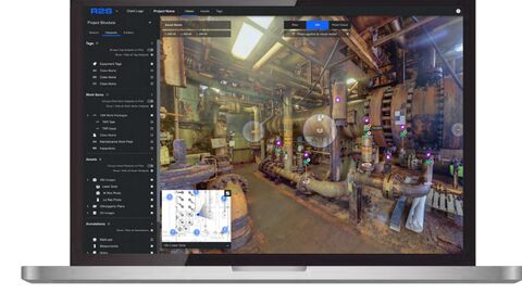
No more chasing down outdated files or second-guessing site conditions. R2S gives you a clear, up-to-date view of the assets you’re working on so you can plan with confidence.
• Fewer Silos
R2S connects your data and your people. Everyone sees the same information, so you can work together more effectively, whether you're in the office or offshore.
• Faster, Smarter Decisions
With accurate, contextual data at your fingertips, you can act quickly and reduce downtime.
• Stronger Compliance
Standardised processes and visual tools help you stay on top of safety and regulatory requirements.
• Future-Ready Operations
R2S simplifies complexity, making it easier to scale and adapt as your projects grow.
Real Stories, Real Impact
- A National Oil Company Saved ~$20M
When a NOC in the Americas struggled with scattered legacy data, R2S helped them bring everything together. They could finally see the full picture, identifying issues remotely, improving planning, and avoiding costly rework. The result? A projected savings of around $20 million and a full rollout across the region.
- 25% Faster Project Delivery in the Gulf
An international oil company wanted to improve remote collaboration and reduce downtime. R2S gave them a virtual walkthrough of their platform, cutting 604 person-days from the project and reducing the timeline by 25%.
- Smarter Anomaly Management
One North Sea client used R2S to visualise anomalies on a digital map layered over 360° imagery, achieving a 99.6% time saving on anomaly localisation. It helped their team understand the site better, manage risks more effectively, and integrate the process into their wider integrity strategy.
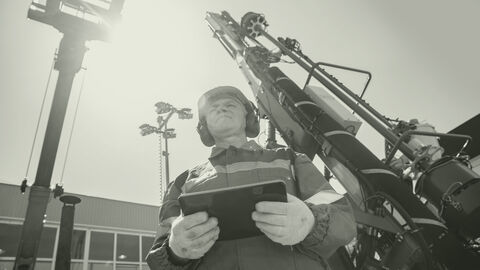
- Two Days to Capture an Entire Asset
A decommissioning contractor in the Gulf used R2S to replace time-consuming site visits with a full digital capture, completed in just two days. No more repeat trips, no more paper-based notes. Just clear, reliable data from the start.